An Ode to the Blank Slate

The Federal DoT created a program for cities without real transit to further-develop vehicle-based mobility alternatives with which they will then call themselves “smart” for doing so. In other words, DoT created the Columbus, Ohio grant program, and – Surprise! – Columbus, Ohio won it.

smartcitychallengefinalistsmap

I’ve written about the Smart City Challenge before, including when I came across a CityLab article that discussed this proposal along with possible mobility-oriented interventions in the Linden neighborhood (one of those interventions was my “Bus Box” proposal). I was pleasantly surprised to see Linden, a neighborhood for which I’ve done a lot of work, getting CityLab recognition. Now that the surprise is over, I am sorry to say, I am a little underwhelmed.

Columbus’ Winning Proposal

It’s complicated. To be fair, this application is about getting people moving, and not necessarily providing old-school “transit.” This grant is deliberately intended to pilot future technologies that should rightfully deviate from how transit is usually provided. That said, it’s also an awful lot of hoopla for a proposal that scrapes the bare minimum. This Wired article offers an excellent and unbiased (well, glowing) account of the full application, which will execute the following projects:

  • Autonomous vehicle pilot project to link currently non-accessible (via transit) employment centers
  • Mobility kiosks in the low-income Linden neighborhood, specifically geared toward pregnant women
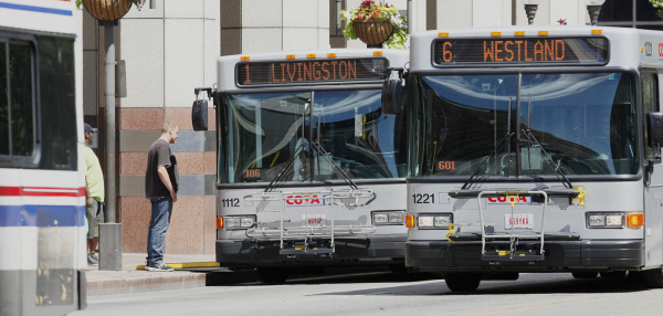
  • Development of a universal transit pass that syncs with COTA (the bus authority), rideshare apps, taxis, and bikeshare

The real strength of the application was the local partnerships brought forth by Columbus’ determination to win this grant. A classmate of mine with an excellent blog detailed the following “total packages” among the 7 finalist cities, in order of leverage:

  • San Francisco: $150 million pledged by local partnerships
  • Columbus: $90 million pledged by local partnerships
  • Austin: $50 million of in-kind services pledged (which could be worthwhile coming from a tech hotbed)
  • Denver: “Total value of $84 million” (so an additional $34 million of leverage?)
  • Kansas City: $15 million pledged by local partnerships
  • Pittsburgh: Additional $11 million pledged by Commonwealth of Pennsylvania
  • Portland: None

Edge, San Francisco.

However, Columbus’ real advantage may have been the blank slate of transit offerings it currently boasts. We have a bus authority. San Francisco has BART which is underfunded but still excellent. Austin has commuter rail. Denver has one of the top LRT networks in the world. Kansas City just opened their new streetcar. Pittsburgh has the T, augmented by really cool “busways.” Portland has it all. DoT may have been attracted by the fact that a Columbus pilot offers the opportunity to implement “smart” technologies in an isolated environment, without cross-over influence of actual transit. As Gizmodo puts it: “Columbus will be able to demonstrate how a city which doesn’t have the time or capital to build out a massive rail network can use the next wave of transportation tech—autonomous vehicles, smartphones, sensors—to get residents moving in an efficient way that will get more cars off roads and lower emissions.”

Smart Challenges For Wicked Problems

Who’s to say Columbus doesn’t “have the time or capital” to build out a rail network? We won’t make time. It’s been a non-starter my entire time in Columbus.

For those that live, work, and get around in Columbus – what does the “Smart City Challenge” victory actually mean? If you’re not pregnant in Linden, what does this victory actually mean? Is everybody in Linden pregnant? What does an autonomous vehicle pilot project really do for a struggling built environment that needs placed-based, not dis-placed, solutions? Having a cool car that can pick you up for your OB/GYN appointment does little for job access, education access, creating recreational opportunities, and fostering passive walkability.

Having written a study on infant mortality in South Linden, I can tell you that lack of car ownership is not an environmental cause. Lack of mobility options, yes, car ownership – not exactly. The full gamut of factors contributing to this neighborhood’s unacceptably high infant mortality rates are:

  • Poor access to affordable and fresh food
  • High obesity rates vis a vis unwalkable environment
  • High stress resulting from crime, speeding traffic noise, and economic insecurity
  • The neighborhood’s only OB/GYN is across the tracks, on a site that was available on the cheap, for lack of resources to build a true neighborhood health center
  • Housing that is often riddled with environmental contaminants
  • Poor maternal care education (prevention of tragic accidents)
  • Other

Linden even has an underfunded BRT-lite project, in need of additional funding and wraparounds to qualify as true BRT, that this grant ignores.

For myself, I deliberately forced myself to use Columbus’ transit for the entire two years that I was in grad school. My thesis was on TOD, and to develop a sense of empathy and deeper understanding, I wanted to experience what it is like to actually rely on transit – too few planners have done this, in my opinion. I can tell you that being reliant on transit in Columbus is not fun. It means waiting for buses that are irregular (my outer backpack pouch has schedules for the #7, #18, #2, #8, and #21 – which I’m pretty sure are just suggestions), unpleasant and stressful, occasionally unsafe (frequent reports of LGBT discrimination and abuse), frequently broken down (I have had three COTA buses break down on me), and so on. For half of the year, add the bitter cold. During the warm months, the buses are often re-routed or indefinitely delayed due to frequent marathons, festivals, or parades on High Street. So while I don’t mean to be a fly in the ointment, I am very passionate about Columbus developing the first-rate transit it so badly needs, and this is not that.

This reminds me of the time I asked the otherwise-excellent outgoing mayor, Michael Coleman (a true role model of civic leadership, I must say) if Columbus was interested in pursuing transit to capture more development demand in the form of sustainable TOD, and his response was “Columbus is so TOD, we now have Car2Go!”

The Case for Real Transit in Columbus

The background context is that Columbus is a community that harbors deeply anti-transit sentiments. It’s a car culture. As Columbus has re-urbanized and more or less “gentrified-in-place” (raising density while developing true mixed-income), it has found auto workarounds. The city routinely grants TIF deals to cover the costs of parking garages to facilitate neighborhood redevelopment. The frustrating thing, as a planner, is that Columbus is a really great city that has what it takes to be “the next Great American City” (sound trumpets) a la Austin or Portland. Transit is the one disconnect – the stubborn pitfall that Columbus can’t get out of.

1922221_189815764686554_1363053789_n

The essence of Columbus is neighborhoods, which is ironic for a city best-known for its iconic commercial spine. Above is the most important photo you will ever see (to-date) of Columbus. Of course I am biased, because it is my own, but this photo illustrates better than I could describe the relationship between downtown, the “neighborhoods,” Ohio State, and the High Street corridor. Despite being such a linear city (not to be fooled by the radiating hub-and-spoke of sprawl, density levels and economic activity literally follow High Street) many voting citizens in Columbus pretend to be pro-transit, but just unsure of where it could go or who would use it. This oft-repeated refrain requires the above aerial study. If any city were ripe for a transit corridor, it is Columbus. You don’t need a Nelson Nygaard study (though we have that, too) to tell you where a rail corridor should go, just go up high and say “Eureka, I have found it!”

cbus.JPG 
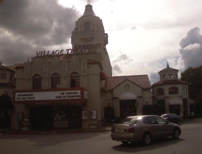
What gives Columbus so much potential is that it is a vastly underrated historic city. Overshadowed by the former fourth-largest (Cincinnati in the 1800s) and fifth-largest (Cleveland in the 30s, 40s, and 50s) cities – Columbus falls for the notion that it too is not historic. On the contrary, Columbus is one of the most historic state capital cities, and features some of the most impressive Victorian-era neighborhood fabric anywhere in the United States. These historic neighborhoods are also dense, walkable neighborhoods. However, it is also best summarized as a collection of independent fiefdoms (unique neighborhoods or “villages”) that have spurned planning and transit to stave off the threat of connectivity to their surroundings. A great example of this is Clintonville, a truly wonderful neighborhood whose infamously NIMBY residents are either known as Clintonvillains or the Independent Republic of Clintonville. I truly empathize for any developer feebly attempting to build very high-end apartments for “those people” (you know, renters, like myself).

These fiefdoms are wonderful places. They’re walkable, charming, and valuable. They could be very transit-supportive. Columbus has an almost-endless list of them, from German Village, to Beechwold, from Franklinton (an emerging fiefdom), to Olde Towne East (shout-out to those OTENA gentrifiers, Flag Wars!) and the rest of the “Villages,” be they Victorian, Italian, Merion, and so on. Their calling card is that they all occupy inner-city locations without inner-city connectivity. While I adore cobblestone and brick-paved streets for aesthetic and sense-of-place arguments, I suspect they have been preserved so well to inhibit drive-through traffic.

The divisions of Columbus bring us to realities about inequeality and the geography of opportunity. The Kirwan Institute, based at Ohio State, is an excellent think tank dedicated to the study of poverty and urban inequality, and best-known for “opportunity mapping.” Their Columbus Opportunity Map, essentially a blended metric of quality of life and economic opportunity across Columbus census tracts, is viewable on Arc online. You have to open the filter control and turn off the neighborhood layer, which is just meaningless color-blocking, and turn on the neighborhood opportunity index. You will then see the following map for all of Franklin County:

cbus.JPG

While economic opportunity follows High Street, those who enjoy that economic opportunity do not cross High Street. To the east lies a sea of neighborhoods cut off from the city’s spine, by railroads, freeways, etc. These neighborhoods’ problems are largely due to issues with access, whether it be to jobs, education, healthcare, etc. We need a transit network that connects these neighborhoods to the economic spine of Columbus. On top of that, truly linking the diverse and multifaceted (and almost entirely densely-populated) communities that line both sides of High Street would catalyze additional economic potential by bridging the gaps wherever they exist.

Toward the Right Solution

m-1_20map-0
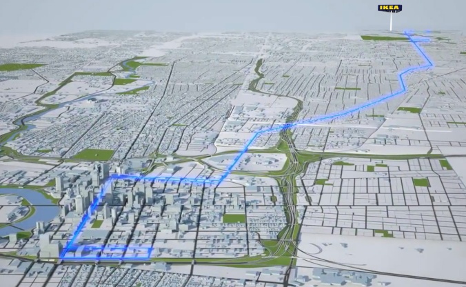
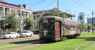
Columbus just won $150 million of funding through an incredible public-private partnership. Cincinnati, Kansas City, and Oklahoma City are all building their modern streetcars (trams) for less than that. However, Columbus needs much more than a downtown circulator streetcar. Columbus needs something like the M-1 Rail, which I’ve covered extensively, which serves a true need by filling the gap and forging strategic connectivity. The 3.3-mile corridor, envisioned as the first phase, connects two currently-disconnected rail systems and makes the broader Detroit Transit Authority bus grid more efficient. Ran by the suburban RTA (SMART), the M-1 Rail will also link the two disparate transit authorities serving Southeast Michigan, and it will do so through a corridor that links all of the city’s major economic, cultural, and institutional assets.

The M-1 Rail is a slam dunk because it is the perfect place-based transit project. It was also made possible by significant private- and philanthropic-sector contributions, which covered most of the cost, in addition to about $45 million in FTA grants.

Sound familiar?

Columbus needs an M-1 Rail, whether that is “smart” or not – something that provides real, meaningful transit. Columbus does not need a ride here and there for expecting mothers – it needs a transit pipeline for everyone.

Nuanced Thoughts on RTA’s Fare Hikes + Service Cuts

Nobody ever stops the press when government works. Everyday, government works to get people to work, to ship goods to markets, to power our economy, and protect our national defense. Occasionally, we do stop the press for major stories when government does not work as we expect. When a bridge crumbles, it’s a headline. When a train derails, it’s a headline. When bus drivers strike, it’s a headline. In all of these cases, lives are disrupted. Also, in all of these cases, rarely is the fundamental issue ever addressed: We do not pay, and seemingly will not pay, for the infrastructure and services upon which we rely; we insist on something for nothing.

The problem with infrastructure and transit is that the entire nation, or even the entire State of Ohio, does not collectively rely on the same bridge or the same transit route. However, as we complain about the cost of individual projects and transit services, our own community’s infrastructure is crumbling because we refuse to also pay for that of our neighbors.

In Ohio, here is how we got into this situation:

screen-shot-2016-04-05-at-11-09-42-am

Nation-wide, here is how got into an even bigger situation, regardless of mode:

change-in-us-transportation-spending

Among modes, the decline has been particularly steep among federal transit and passenger rail spending, which was basically slashed in half during the 80s and never recovered.

change-in-types-of-us-transportation-spending

This all collectively means we find ourselves in a situation in which local government picks up more and more of the tab for transit.

ff_transportationfactsheet_v521

Lastly, for a most interesting chart, particularly for “equity planners” whom decry spending on anything other than bus routes to poor neighborhoods – there appears to be a correlation between overall transit services and poverty concentration. As transit funding declines along with the varieties of constituencies that it serves, the differential between urban and suburban poverty rises. To advocates for “transit equity” meaning transit as a social service: What are you really trying to do?

city-suburb-difference-in-poverty-rate-vs-transit-funding-rate

We now find ourselves with the transit service that we deserve, pretty much. The fragmentation is pretty much complete. Where a unified front could possible exist as an effective force to solve these issues collectively, we find drivers succeeding in shifting money for transit to roads, we find transit-dependent constituencies advocating to shut down transit that serves middle and upper income people, and we find developers and transit growing farther and farther apart. It is 2016 and things are getting worse.

_______________________

What gives? Flats Forward (and/or Backward)

The big debate in Cleveland right now is whether to continue service on the Waterfront Line. The Waterfront Line, completed in 1996, is a 2.2-mile light rail that bends around downtown, following the Cuyahoga River and Lake Erie waterfronts, hence the name. Cleveland’s RTA spent $70 million to build it, and then not longer after opening it, decided to eliminate weekday service on it in 2010. Service levels were then revived in 2013, upon the accumulation of $500 million + in development spurred by the route, adding jobs at Ernst & Young, hundreds of dwelling units (soon to be thousands), and dozens of new entertainment venues.

flats_east_bank_master_plan3

It so happens, that the Flats East Bank project was built with an over-supply of parking. So while ridership has risen on the Waterfront Line, the trains aren’t exactly packed. Transit “advocates” (can you call those who advocate against transit, “transit advocates”) have dubiously branded the Waterfront Line as the Ghost Train. Mark Naymik of the Plain Dealer, generally considered that newspaper’s foremost loudmouth, wants this route to “be the first service trimmed to help close budget shortfall” (sic). (Personally, and this is the only personal opinion I am writing in this piece, but I’m still not over Naymik’s nasty fight in favor of the Ohio City McDonald’s by labeling opponents including myself as the “$6 Beer Crowd.” Seriously, who advocates FOR a McDonald’s in a historic district??) Flats Forward, a non-profit development arm aimed at revitalizing the Flats as a beloved community gathering place, has led the charge to retain service.

What’s at stake, besides hopes of continued ridership growth on the Waterfront Line? Well, developers did make a $500 million investment along it. One of the historic advantages of rail over bus service is that tracks can’t be moved like a bus route often is – and that goes out the window in this political climate. By burning the developers who invest in sites along transit, we get further and further from an ultimate solution to this wicked problem. Let’s not lose sight of a potential solution, in that Americans overwhelmingly want TOD – 73% support changes in land use zoning to encourage TOD. 73% of Americans rarely support anything.

Where the Waterfront Line was just one example of the solution, combining forces between transit and development, that is now at-risk. The reality is that the Waterfront Line is a choice rider service. By spurning those choice riders, as is often the goal of supposed “transit equity,” it becomes harder to pass needed local tax increases to support transit for everyone.

Don’t forget that the only reason Cleveland RTA is able to provide Ohio’s only decent transit system isn’t fare revenue, but rather the 1% county-wide sales tax that supports RTA. While other Ohio cities would kill for that (COTA in Columbus for instance must operate on half that), will County voters renew Cleveland’s RTA tax next time it is up the renewal? Keep burning choice riders, and County voters are less likely to see how they could benefit.

bus11

What we have here is ultimate dysfunction and fragmentation in which transit segments have turned against each other to throw each other under the bus. While we are all implicit, it is hard to blame anyone specifically; while each side seems to have missed the big picture, can you blame them considering what an ugly picture it has become?

Linking Linden via Design

There are two types of cities that I have worked in, though I’m sure others abound. My experience however has been either economically-driven cities (Dallas, OKC) or equitably-driven cities (Cleveland, Columbus to some extent). For the economically-driven city, the bottom line is the bottom line. They will listen to city planners and urban designers who can offer economic development. For the equitably-driven city, it’s about quality of life for the disenfranchised.

412box7fsnpl-_sx331_bo1204203200_Cleveland after all is the birthplace of “equity planning,” which is a school of thought founded by Norm Krumholz that honed in on planning for the poor to the exclusion of others. Krumholz’s philosophy, which soon caught on in most major cities, was a response to the times, following race riots from which most major cities have yet to recover. Cleveland for certain was rocked by the Hough Riots of 1966 and the Glenville Riots of 1968. The groundbreaking literature on this matter was Krumholz’s 1975 Planning Policy Report, admirably discussed in this article by his fellow FAICP predecessor Bob Brown.

citywidemap20transparentRegardless of in which category a city may fall, no city is practicing planning for fun. Nobody in a major city, strapped for time and resources, has time on their hands to engage in academic exercises. Columbus is also an oddball hybrid community that is probably equally motivated by both the economy and equity. Just when you think economic development matters always win, the city’s disenfranchised communities get a big win. As far as putting our money where our mouth is: Nearly all place-based resources (CDBG, LIHTC, Urban Infrastructure Recovery Fund, grants, discretionary spending) are targeted to low-income neighborhoods, and nearly all TIF resources are targeted outside of the I-270 beltway, representing a strategy schism.

Cleveland Avenue in Columbus is the context for my most significant personal foray into equity planning – specifically the South Linden community located along Cleveland Avenue, between Hudson and 11th Avenue. This community was the focus of Ohio State’s Fall 2015 Community Design Studio with Dr. Jesus Lara, for which our client was the City of Columbus’ Celebrate One Initiative. Celebrate One is an initiative responding to Columbus’ worst-in-the-nation infant mortality statistics. After studying this matter in great detail, the city, county, Columbus Foundation, and other non-profit partners have concluded that infant mortality is spatially concentrated in areas that suffer from pollution, low walkability, high crime, economic distress, and substandard (unhealthy) housing stock.

There is a must-read study on this matter from Wash U in St. Louis. The takeaway: “Your ZIP code is a better determinant of your health than your genetic code.” When it comes to neighborhoods such as this, not only is equity planning a good approach, but it pays dividends to start making partnerships and inroads with public health officials. In equity-driven cities, the public health officials are going to hold a lot of sway, have more resources, and probably be sympathetic to planning goals. 

walkscore

In addition to astonishingly high infant mortality, the neighborhood also suffers from substandard and often lead-paint-covered housing, low walkability, high traffic noise, proximity to brownfields, poor air quality, and high crime. The high crime is in part due to broken street lights and un-maintained rear alleys that make the perfect spot for a shady drug deal gone bad. The rest are primarily due to poor transit access, adjacency to high-traffic I-71, and the speedway that is Cleveland Avenue (especially heavy commuter traffic that barrels through the neighborhood to bypass congested freeways).

By the way, Walk Score deduces that South Linden is the 42nd “most walkable” neighborhood in Columbus. This was determined not by visiting and documenting existing conditions, but rather through a computer algorithm that relies on “amenities” it picks up on Google Maps. Many of these “amenities” look nicer on Google Maps than they are in reality – many are no longer open at all – so the reality is actually much worse than Walk Score’s imputed result of “Somewhat Walkable,” but it is a good empirical starting point nonetheless.

Should one actually visit to document the existing conditions, I recommend just taking the #8 or #1 bus and just hopping on and off, talking to lots of neighborhood residents in between. Here are some photos from such an excursion:

The above photo with a bus is actually just the “typical bus stop,” which not unlike elsewhere in Columbus, is basically a pole with a sign. Despite its relatively low walkability, the community has some of the highest rates of transit ridership in the area (4,800 daily riders on the #1 Bus), due in part to the transit-dependent population (no car). Transit in this case is seen as a last resort, and due to its undesirability, is not only relegated out of the way of the area’s motorists, but it’s also ditched by transit riders themselves as soon as they can afford a car.

cota-brt-01-ikea

To ameliorate this problem the city is giving the Cleveland Avenue corridor our first BRT system, albeit a BRT-lite. The Cleveland Avenue C-MAX is a $47.7-million project BRT with enhanced stations and rolling stock, but without a lane or signal priority. The C-MAX is one of the most significant recent investments in the northeast side of Columbus.

The C-MAX project is my base line for improving the South Linden community, to the extent that our Community Design Studio was tasked with creating design interventions that enhanced quality of life for this neighborhood’s residents. It’s an urban neighborhood, and it’s a transit-propensity neighborhood, so it should also be a walking neighborhood. Reaching people while they’re waiting for the bus is the most-targeted way to touch lives. It’s also a way for these design interventions to really help the people who live here, and not the people who don’t.

12370951_10154349799872656_4433606226801660606_o

As the member of our studio that focused on transit placemaking, I proposed two design interventions: Bus Box and the “Heart of Linden.”

Before12365971_10154349793792656_7786352688850274334_o

Bus Box is a bus shelter made by cutting, combing, and painting shipping containers. Not only is it cheap and trendy, bringing an avante garde style to the neighborhood, but additional “boxes” can be used for community info kiosks, a farmer’s stand at the bus stop, or a “bodega box” that just sells essentials.

It’s tailor-fit to this neighborhood’s needs, which is a food desert for its lack of retail and specifically fresh food options; despite efforts to build suitable retail space, area residents still can’t afford the rent. A lot of the neighborhoods carry-outs get themselves in trouble by selling mostly booze, cigarettes, and junk food in order to pay their rent. Rent won’t be a problem at a Bus Box, and successfully incubated retailers will then be in better position to afford rent in the bricks and mortar behind it.

12339072_10154349795752656_8606821648062212075_o

Heart of Linden is basically just taking the worst block in this neighborhood (albeit beautifully fenced-off), also located at the heart of it, and re-activating it. “Heart of Linden” has two main components, a scaled-up Bus Box that can basically become an edgy low-cost retail incubator, and a “Food Hub” not unlike the one proposed previously for Weinland Park. There is currently an effort underway for a similar Food Hub in South Linden, and it makes sense that this needed project (and a potential neighborhood improvement catalyst) locate on a prime site. All of the other uses are just programming expansions and connections to surrounding assets, like potential bike trails or the new library.

Bus Box is certainly more practical. It is built off of ideas I have seen in other cities, such as LAND Studio’s Bike Box project in Cleveland (where they built 8-10 of these). Heart of Linden, certainly a tougher project to take on, seeks to solve a number of challenges through forging the right connections. A lot of Linden’s problems stem from disconnectedness. It just isn’t a pleasant neighborhood in which to walk, so nobody is going to belabor themselves worrying about the pedestrians of South Linden.

But they should.

Beyond offering needed amenities in a well-connected site and layout, Heart of Linden is an intriguing idea as a “BRT-OD.” I’ve obviously written a lot about transit-oriented-development or TOD, and it goes without saying that I’m a believer in the power of rails toward the goal of generating this coveted prize. That said, I concede that BRT can move the needle a little bit. It won’t be the sole driver behind billions of dollars in TOD, but it can contribute, and it doesn’t hurt. So just as BRT is a practical innovation, what if the TOD model could similarly be innovated to fit that practicality? As such, a “BRT-OD” could be more of a temporary re-activation of a site, not unlike a pop-up city, and could rely on technological innovations to give it a lighter footprint and lower up-front building cost.

What if “BRT-OD” is a way forward in terms of integrating these BRT systems with surrounding low-income neighborhoods? I leave you with that thought.

Design Ingenuity: Vikings’ new MetroDome

maxresdefault1When stuff turns 50 years old, a switch is flipped. Nobody wants that junk anymore. And if it wasn’t junk, it is now. This happened in the 70s-80s with Art Deco mid-rise buildings in Oklahoma. Once the grandiose old urban core became 50 years old, it was time to bring in I.M. Pei and tear down 2,000 great old buildings. But this post isn’t about OKC and its troubles and rubbles. This is about what’s rising out of the rubble of the MetroDome in Minneapolis. (Or maybe not rubble as much as tattered pieces of inflatable roof.) It’s about an NFL stadium, which is an odd thing to celebrate in a new feature I’d like to call Design Ingenuity. I’ll do these posts for anything I see that really inspires me as an urban designer. Just perusing through Minneapolis projects, an all-around inspirational city honestly, I was really blown away by the new US Bank Stadium.

Important Note: This inspiration is also in part underscored by the fact that NFL stadiums are among the worst thing our society is building right now. It’s a beacon of corporate excess and waste, public finance and corporate welfare, and all of these evils. Yes, I get it – we have people starving, even a small proportion living in poverty in Minneapolis I’m sure, and yet the Twin Cities are subsidizing a $1 billion stadium. IT is what it is. For some perspective however, they’re getting a lot more for it. “JerryWorld” AKA AT&T Stadium in Arlington, TX was $1.3 billion in 2009, $1.45 billion in 2016 dollars. They got nothing. A super huge dysfunctional venue that can only host sporting events, surrounded by not a sea but an ocean of parking, across the street from a Wal-mart and an interstate freeway. North Texas for ya.

By comparison, the Vikings stadium is $1.06 billion which is a lot, but nearly 50% less, for a more impressive football stadium. Beyond that, they got the Vikings organization to financially contribute significantly. $551 million from the Vikings, $348 million from the state, and just $150 million from the city. Also compare to Cleveland, where the Browns organization LEFT TOWN in order to force Clevelanders to pony up most of $300 million for their new stadium, and just last year broke the bank again for $120 million in renovations, with $30 million coming from the City of Cleveland just to pay for a new scoreboard. Since $30 million is nothing, most of it actually comes from Cuyahoga County’s sin tax. Ugh. Did I mention that Minneapolis is getting a true architectural gem and a real catalyst for economic and community development? It isn’t a difficult argument to make that neither Arlington nor Cleveland will see similar outcomes from their stadium boondoggles.

I saw this stadium (nearly complete even) when I was in town. You ride right past it on the Hiawatha Line LRT, and switch over to the Green Line LRT at the transit mall right in front of it. Still yet, I didn’t realize how cool it was. My impression from seeing it still under construction was that it was cool, but not necessarily inspirational. Actually, when I came around the bend approaching it, I didn’t realize it was an NFL stadium. It doesn’t look like a stadium. It looks like.. I don’t know, you tell me:

rdchvmn

US Bank Stadium construction aerial from mgoblog.com

From the other side and inside:

It’s a Viking ship!… “setting sail toward downtown Mpls.” How cool is that? The entire stadium’s design has been inspired by a Viking ship, and not just its exterior. The internal structural supports, holding the roof up, are designed to look like sails. Outside, on a corner where you can see the tapered “ship-shape” angles of the stadium, is a public art statue called the “Legacy Ship,” where local die-hards can buy “legacy bricks,” which they will do because you can coherently envision a great legacy coming from this design. My family are primarily Vikings fans, especially my aunt and uncle who have season tickets in Minneapolis, and even though I never got into it I am thrilled that they can be a part of something that is very cool.

But it gets better. The stadium is located right downtown, on the site of the old MetroDome, and totally surrounded by rapid redevelopment. Minneapolis is booming. They have 40,000 downtown residents and are trending toward 75,000 by 2025, which they will probably reach. Minneapolis, indeed, is booming. One of the main reasons for this would be the extent to which they invested in transit, and this project is no different. While most of the $1 billion is for a football stadium, just as the public art was not cheap either, they have also integrated a not-cheap light rail transit mall into the project. Local Tea Party folks are balking at the “ballooning expense” of the $8.7 million pedestrian bridge that carries fans over the tracks and onto the platform, where a train takes people to and from the game. Right now you can just walk on top of the tracks because they aren’t grade separated. There are numerous at-grade crossings that work just fine. So why the bridge?

The explanation lies in this Finance & Commerce article. Once the still-incomplete Twin Cities light rail network is complete, at least as envisioned up to this point, this stretch of tracks will serve as the central hub and transfer point for the entire system. Trains will come through on average every 2 minutes. Let me say that again: Every two minutes, a light rail train rolls through this transit mall. Since trains take a minute (especially at an important transfer point with other LRT lines) to allow for on- and off-boarding, there won’t be many opportunities to cross these tracks on foot. Especially when 65,000 fans get out of a game, along with countless thousands more that fill downtown bars and restaurants during game days. So in this instance, the light rail bridge is a core piece of this stadium project, which has led the city and Vikings organization (which contractually captured ad revenues from the station to pay off its roughly $2 million contribution) partnering on this.

So there you have it. Rather than just building a stadium, Minneapolis is building a legacy. Not just a Legacy Ship, but a project that has been inspired by this legacy in every way, including when it comes to structural supports, the roof of the stadium, its shape, it’s orientation on the site, and so on. Most importantly, they are building a legacy of equitable access not just to and from games, but the surrounding area as well. They didn’t just think of transit, too; they made the light rail access point a core piece of this project, recognizing that by doing so they can legitimately expect Vikings fans to take the train to the game.

Go Vikings. – Sincerely, city planners.

Cleveland: RTA “Rapid” Photo Tour

Cleveland, once the fifth largest city in the United States before its suburbs took over, is one of those cities that inherited an old-school transit system. In a way, it’s Rapid Transit system is manifesting new-school trends as well, diversifying its modal split in recent years. The old school still prevails though. While best-known for its award-winning Healthline BRT (which was supposed to be light rail, but switched to BRT in order to get FTA funding), the older rail network still carries the bulk of ridership.

21x22MapPaths-2005

Slide1

Overview of TOD across the entire city

Its 19-mile, heavy rail (think MARTA or WMATA) Red Line dates back to the 1950s, and carries 19,500 daily riders in retro “silver bullet” trains, which is higher ridership than the Blue and Green lines combined. Utilizing a historic railroad trench, most stations are grade-separated – TOD designs are just now emerging that facilitate a seamless integration with that grade separation. Every single Red Line station has recently been rebuilt. Red Line station redevelopment has been a decades-long initiative, primarily moving from west to east. The Red Line connects the Airport to Tower City through westside neighborhoods such as Westpark, Lakewood, West Blvd, Detroit-Shoreway, and Ohio City. After Tower City, the eastbound Red Line connects to University Circle and East Cleveland through some of the east side’s hardest-hit communities, such as North Broadway, Fairfax, and Kinsman.

For the photo tour, I will start with the westside Red Line – but it is worth noting that all of these photos are from 2013-2014. Where possible I will contrast these outdated photos with renderings and newer photos from myself or the media. I need to take newer pics one of these days, but I’ve just gotten out of the habit of doing this in my adopted hometown:

ohio-city-site-plan-phase-3ajpg-bae80e8614bb5231

Large TOD planned for a current strip mall site that separates the Red Line from the iconic West Side Market

ecovillage_sketch

The half-completed Eco Village surrounding the W. 65th Red Line Station

Tower City offers connections to the Blue and Green lines to Shaker Heights, the Waterfront Line to the Flats and lakefront, as well as the Euclid Avenue Healthline BRT. Tower City is one of the nation’s largest and oldest TOD’s, originally built by railroad moguls O.P. and M.J. Van Sweringen. The Van Swearingen brothers actually founded the Cleveland Interurban Railway to connect their master planned suburban development, Shaker Heights, to Downtown Cleveland. Tower City, then the Union Terminal Complex, was the western terminus for that transit network, which anchored downtown’s Public Square.

Public Square is a large, 4-block commons area in the dead center of the city, typical of communities founded in the Connecticut Western Reserve. Just as Cleveland’s open space legacy harkens back to its New England roots, so do its liberal politics and extensive transit legacy. Before Tower City was finished, there was Shaker Square – the entrance to Shaker Heights, and where Van Aken Blvd (Blue Line) and Shaker Blvd (Green Line) split. To this day Shaker Square is one of the city’s hottest and most-integrated neighborhoods, a testament to the enduring value of transit-oriented real estate. On the other end of the line, transit is being totally revolutionized in Downtown Cleveland – particularly with the new Public Square. Below are some photos inside the Terminal Tower complex and the adjacent Public Square. Renderings of the new Public Square follow.

12553626-mmmain

$32 million makeover of Public Square, designed by James Corner Field Operations (designer of NY’s High Line)

October+16,+2015

It doesn’t get more real than this

Fare thee well old Public Square, hello new Public Square.

The new Public Square and corresponding improvements to Tower City, including the $400 million Horseshoe Casino, aren’t the only transit-oriented development change in downtown. In fact, it is downtown’s western periphery – the Flats East Bank, Warehouse District, and the lakefront – that show the most promise for TOD. While much has recently been finished, more is underway currently – the largest impact will be plans that the city will get to after the RNC Convention. The Waterfront Line is the $70 million extension of the Blue/Green lines past Tower City, to wrap around downtown. While it was “finished” in 1996, it has always been considered incomplete – original plans included a complete loop back into the Rapid system, around Cleveland State University.

Ridership was so low when the Browns left town until a new stadium was built that service was discontinued shortly after its completion. Service was resumed in 2013, but ridership remained low until the Flats East Bank development opened. This line will be further rejuvenated by a Cumberland Development and Trammel Crow project at North Coast Harbor, in between the Browns stadium and the Rock & Roll Hall of Fame. This area will also be bridged to Voinovich Park by a $25 million modern drawbridge, that may also connect to a new intermodal transit hub that will replace an embarrassing Amtrak station.

I find it incredible that this bridge costs almost as much as the entire Public Square redesign, which underscores two things: in the public works realm, $32 million for a high-quality project like Public Square is an incredible bargain; and secondly, the city is all in on this pedestrian bridge to the lakefront. I hope there is a good way to match its design up with the intermodal rail hub, but it may be too late. The drawbridge is already funded, but has been delayed by a promised “downtown construction freeze” for the RNC Convention. After that date, the city will also start discussing (ie., look for funding, hire designers, start planning, etc) the lakefront rail station. As a final note, redevelopment in this area will be complicated by a 70-foot grade separation (downtown sits on top of a bluff, above the lakefront), as well as parking lots that are known as Browns tailgating ground-zero (this is a big deal).

As I mentioned above, this line is heavily in flux with several projects currently in various stages. The Flats East Bank project is nearly finished, the new drawbridge is funded and about to break ground, the North Coast Harbor is similarly financed but still on the boards, and then the new Amtrak/intermodal hub is still in discussions.

Of course, this blog article would not be complete without mention of the Healthline. Not unlike other transit authorities that volunteer themselves to FTA to be BRT guinea pigs, the transit authority’s own focus has shifted to the surprising success of the Healthline project. It helps that Euclid Avenue is the historic “Millionaire’s Row,” built-out all the way to Wickliffe (suburban Lake County) by the Rockefellers and their ilk.

The Healthline has been described by proponents as light rail with tired, and by detractors as a “federally-funded streetscape,” yet from my point of view those are both good things. I have covered the Healthline TOD phenomena ad nauseum, including a lengthy expose at CEOs for Cities that showed both sides of the coin. Given that the Healthline’s center-lane alignment and platform stations were designed to allow for easy future conversion to light rail, I’m a fan.

The project also branded the Euclid Corridor, the city’s iconic main street, and got the east side of Cleveland moving. The distinctive corridor project has been an undeniable magnet for TOD, nearly $6 billion according to this heavily BRT-slanted ITDP study. While most of it has been market-rate development with minimal affordable development to date, making it feel perhaps more like Dallas than Minneapolis. Despite that, this is all the more incredible given the weak market conditions along the corridor, and the fact that most all development has just been infill with no displacement potential. As crazy as it sounds, this bus project really was the impetus for Downtown Cleveland’s remarkable resurgence.

It’s worth mentioning that a lot of the $5.6 billion in TOD was mostly institutional expansion that may have been negligibly spurred by the Healthline. While these institutional actors (such as Cleveland State University, the Cleveland Clinic, Case Western Reserve University and University Hospitals, etc) may have still needed a green light from the public sector before reinvesting in their physical presence along Euclid Avenue, you can’t seriously attribute the expansion of the Cleveland Clinic to a BRT system. There are Saudi sheikhs who maintain private wards at the Clinic just for when their family needs check-ups. The magnitude of the Clinic is not even in the same ether as Euclid Avenue and its bus rapid transit, and for better or mostly worse, the planning of the Clinic (and its cornucopia of parking garages going up every year) reflects this. In my opinion, TOD should have to be underparked in order to qualify.

The Healthline is also not perfect. Signal prioritization absolutely does not seem to be working. I say that because I was a frequent Healthline rider who sat at many a traffic light in my day, which is the whole point of signal prioritization, especially when the BRT has its own lane. In fact I’m pretty sure the only purpose of the traffic signals along Euclid is to first infuriate everyone, then put cars second, and transit last. The route is also longer than BRT can be expected to remain on schedule. Also, due to congestion in University Circle, the ideal center-lane alignment gives way to curbside-alignment and mixed traffic operation.

It is that eastern end of the Healthline corridor that is perhaps the strongest. That is also where the Healthline is least Healthline-like (just described above), which also casts aspersions onto the catalytic extent of the BRT itself.

While the long-term civic vision of Downtown, Midtown, and University Circle being continuously bridged is slowly coming to fruition, the pace of infill is rampant in the last two miles of that 5-mile trek. University Circle is the hottest square mile of real estate in Ohio, and to get there, you have to first traverse the mile-long Cleveland Clinic campus. You don’t necessarily have to go through Midtown, though. Motorists often prefer the scenic route on MLK Blvd and Rockefeller Park’s cultural gardens, while transit riders may prefer the tried-and-true Red Line which has 1/4th the number of stops along the way. The eastern Red Line is just now getting its new stations, except for some that may realistically just be closed. Below are two year-old photos, with photos of the new stations at Cedar and Mayfield roads. Major TOD is transpiring at these gateways.

And now for the transformative new stations, and resultant TOD:

Lastly, the oldest transit asset in all of Cleveland – the Shaker Heights Blue and Green Lines. These two combine for around 15,000-17,000 daily riders, not bad – but certainly brought down by lower density in affluent Shaker Heights. This is another case where what is old is being made new again. The Shaker area, beginning at the St. Luke’s redevelopment area at MLK, connecting into historic Shaker Square, and then splitting up through Shaker Heights – is seeing renewed development interest along the Rapid. Some of this is legacy real estate, including Shaker Square and Van Aken Blvd’s linear mid-rises. Some of this is recently completed, particularly at Lee Road, between Van Aken and Chagrin.

As with many things in Cleveland, the best is yet to come, with the Van Aken District now under development. Van Aken is the redevelopment of a huge strip mall that used to sit on a complicated 6-way interchange. Roads are being reconfigured, the Blue Line is being extended across the interchange (where it used to terminate), and new urbanist infill is taking over on all corners.

First, the Cleveland-proper parts of the Shaker area (St. Luke’s Hospital area and Shaker Square):

Lastly, the Shaker Heights-proper part of the Shaker area, where higher-end TOD is beginning to transpire.

All of the above (for the Shaker part of this post) is about to soon by overshadowed by Northeast Ohio’s largest TOD in nearly a century: The Van Aken District.

19376437-standard

Rendering looking NW to SE through proposed Van Aken District

van-aken-designs-f52d1b0b49a5e531

Site plan diagram

That, from these ashes:

van-aken-arial-view

Existing conditions at Warrensville Center Road / Van Aken Blvd / Chagrin Blvd intersection

While all of these rails may have lost some of their luster, they still work well. They are traversed by around 40,000 passengers daily. They are the formative first experience of many newcomers, when they first land at the airport. They may not always comprise the scenic route, but there is a good chance they can get you where you need to go. They are Cleveland’s most underutilized practical development asset, which it is just now beginning to realize.

The future of transit in Cleveland is in flux. The city is currently debating a contentious fare hike that will undoubtedly hit the poor the hardest. Transit in Cleveland, and the breadth of access it provides compared to other Tier 2 metros, is still a bargain. Even the Healthline’s naysayers will admit that the Cleveland RTA is very well-ran, which goes a long ways. RTA has identified 10 “transit-propensity” corridors, which is a way of saying that they have a priority list of Cleveland’s primary corridors.

The agency just completed a $20 million BRT-lite project on Clifton Avenue, which serves high-density pockets like West Blvd, Edgewater, and all of Lakewood. The agency is currently beginning a project to extend either the Red Line or Healthline eastward, all the way to Euclid (population 55,000). It will hopefully be Red Line extension that is chosen in the end, but that will be dictated by the planning process that is currently underway. Lorain Avenue and West 25th are likely next-up, and activists are already duking it out in the media. Me thinks West 25th would be a phenomenal streetcar corridor, and so do many others, including Ohio City Inc. RTA may go path of least resistance with just another BRT-lite.

P.S. For some extra reading, here is the text of the CEOs for Cities article. While they cleared their website, it made it up onto some blog or forum. The article is one of my better pieces, offering a fair and balanced look at the Rail v. BRT debate in Cleveland.

P.P.S. Please ask for permission before reusing pics. Almost all are mine, but some are from Cleveland.com. Renderings are obviously the intellectual property of the architect and/or developer.

Denton A-Train is just that: A train

Finally getting around to posting my photos from the Denton County Transit Authority’s “A-Train” system, from which I came away with some surprising impressions. For the sake of brevity and organization, they are numbered below:

  1. Very low ridership. Only 1900 daily riders. Yep, you read that right.
  2. The 21-mile corridor, finished in 2011, hasn’t had enough time to generate much TOD.
  3. Good TOD is happening in Denton, Hebron, and Carrollton. Give it time maybe?
  4. Bad service frequencies. And schedule. Had to wait 40 minutes when I parked in Downtown Denton.
  5. Also expensive. A day pass was $10 (!!). That said, it was also valid on DART. DART alone is nation’s largest and most-comprehensive LRT network, and the 21-mile A-Train trip could save I-35 commuters a lot of time and gas.
  6. Bad information. Upon return, actually missed the last train because I was going off of an old schedule. There are three differing schedules online and they don’t have an effective date printed at the bottom like you’d expect. Let’s just say that was an expensive Uber ride, but it was a good exercise in understanding the unreliability of the Denton rail system.
  7. Beautiful trains and stations. Absolutely immaculate system. Very clean. Brand-new Stadler diesel multiple-unit coaches. When the more heavily-ridden DART trains are parked side-by-side, you would never guess which system nobody uses, comparatively.
  8. Follows existing railroad corridor that even awkwardly cuts through some new subdivisions and apartment complexes.

The photo tour starts in Downtown Denton, which has a really nice historic square. Denton itself is well-known as a liberal college town that, as the seat of Denton County, has exploded with growth. Denton is centrally-located in the huge county, which in 1990 had a population of 273,000 – up to 753,000 in 2014. In that time, Denton itself has gone from 66,000 to 128,000. While most of the growth is actually in between Denton city and the Dallas County line (Carrollton), Denton has in-fact captured a lot of that growth, which has fueled mostly subdivisions and a few denser complexes in-town (mostly around the University of North Texas). The A-Train then follows what is essentially the I-35 E Stemmons Freeway corridor through the wasteland that was formerly the blackland prairie of North Texas.

DART Light Rail Review

While I was in the area over the Winter Break, it made sense that I should take a day trip to Dallas to see how the nation’s largest light rail network has fared in attracting development. Dallas Area Rapid Transit, with 90 miles of track and 238,000 daily riders, has its own TOD implementation office. For anyone interested, their website has a pdf download for each of its stations, showing all of the TOD at each of its 62 light rail stations.

Coming from OKC, I parked my car in Denton, and purchased a $10 (!!) day trip card that was good for both Denton County RTA and DART. It was the only day trip option available in Denton, where the A-Train has been one of the least-successful passenger rail projects. Upon returning from Dallas at 8 p.m. on a weekday, I had to uber my way through Denton County just to get back to my car, because the DCTA’s last train had already passed. More to come on the Denton A-Train, but for now here some photos of its larger, more successful neighbor to the south.


And then my iPhone died with 30% battery life remaining. Nonetheless, I was convinced that Dallas is worth a look if studying TOD. I came to this conclusion after spending a day riding mostly lesser-developed lines, the A-Train and Green Line. Even these lesser-developed lines have been successful in moving the needle on investment and density, just as their more successful counterparts (TRE, McKinney streetcar, Oak Cliff streetcar, north red, orange, and blue lines, and east green line) have been in more established parts of Dallas (Central Corridor, Irving/DFW, Deep Ellum, Fair Park, etc). For a tour of neighborhoods along the north red/orange line, see my 2009 post on “Dallas: Shopping and riding the rails.”

Some of the better pics (keep in mind, 2009):

img00815

Red/Orange Line North Park Mall – Park Lane Station

North Park Mall / Park Lane R

img00811

Historic retail node at Mockingbird Lane and Preston Road

img00808

Historic retail node at Mockingbird Lane and Preston Roa

img00807

Historic retail node at Mockingbird Lane and Preston Road

img00798

Mockingbird Station, near SMU

img00796

Mockingbird Station, near SMU

img00791

Mockingbird Station, near SMU

img00800

Mockingbird Station, near SMU

img00793

Mockingbird Station, near SMU

img00785

Mockingbird Station, near SMU

img00789

Mockingbird Station, near SMU

img00780

Mockingbird Station, near SMU


(Notice the same trains. Looking just as outdated in 2009.)


dartrailmapaug2014large


Transit-Oriented Development: More about Orientation than Transit or Development

Cities and Solutions Under Assault

Transit Oriented Development, a term coined by Peter Calthorpe in the 1980s, has become a quintessential rallying cry for planners seeking to move American cities forward. Despite near-unanimous consensus on the need to maximize TOD in order to make cities successful, the buzz-wordiness of the notion now has critics claiming everything is TOD. Worse yet, this now has many cities rationalizing whatever it is that they have as “TOD.”

An example of rationalizing: At the OSU Knowlton School of Architecture, we recently had a “Planner’s Panel” on TOD in Columbus. It was a fabulous panel with city planners from Dublin, a remarkably progressive city, our fairly progressive MPO, our downtown SID, etc. For those of you that have been to Columbus and think you’re missing something, you’re not. We don’t have any TOD. But give us 5 minutes, and we will tell you all about how close we are.

ohio-city-site-plan-phase-3ajpg-bae80e8614bb5231

Damned if you do, damned if you don’t: The reality is that TOD has been elusive and “true TOD” still evades even the most progressive communities. (An example of this might be Cleveland’s proposed TOD at the West 25th Red Line station, complete with 555-575 parking spaces. So is it really “true TOD?”) As the concept becomes more shrouded in smoke, many of the more independent thinkers now avoid it altogether for fear of being cliche. Sidebar: I know we’re all looking for the “IT Factor” in how we plan with limited community resources. Usually in business, a good bet is the one everyone is sleeping on or can’t figure out (as long as you can figure it out).

st-charles-streetcar

The iconic St. Charles Streetcar in Uptown NOLA.

One of the more cringeworthy revelations toward this end is Jarrett Walker’s recent assertion that “most urban redevelopment is bus TOD.” Uh yeah, a respected urbanist actually said that. Generally, equity-focused planners (a niche that is historically prone to self-defeatism, in this case perfecting the “deer in the headlights look” with the spread of gentrification along transit routes) have always used their advocacy outlets to dog streetcar projects on any basis that they can (see: CityLab, any articles tagged “streetcar”). They attack and smear struggling cities such as New Orleans that want to harness rail-based transit to turn their situation around (although it seems like unfairly attacking anything New Orleans does is all the rage these days). The worst, perhaps the most dangerous of the mavericktivistsMatthew Yglesias’ VOX screed proclaiming streetcar projects to be categorically “evil.” I am reminded of that time that Hugo Chavez insisted he smelled sulfur after taking the podium following George W. Bush. Pot. Kettle. Black.

264100_2056634249073_2486104_nAnd then, sometimes equity planning’s defense of bus-only transit is downright hilarious. Meet the “Coolest Bus Around.” Why would anyone want a clean, modern, efficient, well-designed LIGHT RAIL when you can have a bus with a hot driver? No? Well you must not get all hormonal when you step onto the typically squalid city bus. You’re just not getting the right contact high when you ride the buses in your town.

Battleground Backyard

______________________

Simply put, modern transit and TOD has become a battleground. Just about everything in urban planning tends to become a battleground, as it’s sometimes hardest to marshal a consensus on projects in our own backyard. We all need to take a deep breath and find ways to move forward on transit. Collectively, holistically, and comprehensively. As a rail advocate, I’m willing to extend the olive branch in agreeing that we must leverage rail corridors to make bus networks more effective. There has to be a place for both. That said, I would rather err on the side of modernity than that of antiquity. ‘Nuff said.

It shouldn’t be bus or rail, zero sum, winner takes all. I understand that’s easy to say when my end goal is just moving the needle a little on rail, however, this isn’t an incremental ploy I’m proposing. I genuinely think with a few small additions of rail, the whole picture for transit can come into focus. With the addition of rail that serves as a “high-frequency spine” that bus routes feed into, with multi-hub corridors that syncs the two transit modes together, American cities can very easily offer premier transit service. It will be those cities – with the ability to make sense of the bigger picture and the combined roles of rail, bus, and cars (maybe even “driverless cars”) – that have the biggest upside in the 21st Century.

If we all take a deep breath on this issue, I’d like to make a new point (I promise not to go all mavericktivist): Transit Oriented Development requires Development Oriented Transit. It goes both ways. Re: “everything is bus TOD.” No, not everything is bus TOD. In fact, bus TOD is almost negligible. It just doesn’t pass the scrutiny of essential nexus. How much development is deliberately oriented toward and not away from a bus stop? There has to be a mutual relationship between the TOD and the transit. When you run public transit as a social service, you limit your TOD to facilities that provide social services. That’s the unfortunate reality, and that’s coming from someone who rides the bus every single day.

COTA_STRIKE_CRR2

High Street in downtown Columbus is clogged with slow-moving, view-blocking, often-stalled, and smog-billowing buses.

Here in Columbus, efforts to stymie rail planning and transit have been remarkably successful over the last 20 years. Despite countless plans and proposals, Columbus can now lay its claim as the largest city in the nation without passenger rail. Many transit activists attribute some of the city’s development boom to the city’s hyper-concentrated bus service along High Street (served by 6-7 bus lines, with almost all bus routes funneled down High Street through downtown), where development has also been concentrated. Correlation is not causation. The reality is that the occupants of new spaces built along High Street exist in spite of the buses that plague the corridor. Developers are finding creative ways to detach their projects from the surrounding streetscape due to this, and unfortunately, there are no shortage of ways to do this: No street retail, parking podiums, tinted first floor windows, landscape band-aids, plaza/moats, and more.

Here’s a quote from a Columbus Dispatch article three days ago:

Local retail consultant Chris Boring said it is difficult to make retail work on High Street because of bus traffic and the lack of parking.

“The focus needs to shift away from High Street,” he said, even as new multi-use projects on High Street include first-floor storefronts, such as the Day Cos. plans to refurbish three buildings along N. High north of Long Street.

What pains me is the obvious disconnect that I am seeing. We don’t need more transit-resistant development. We don’t need more anti-transit, anti-development, and anti-equity. We need all three of these things to work together and move each other forward. There’s an assumption that retail needs people with fat wallets, whom we all know only show up in cars (I hope not). There’s also an assumption that rail transit is a ploy to create transit just for the rich (because they don’t need transit). Underpinning all of this is an assumption that the two sides can not work together.

That’s the problem we face today. We need to come together, not come apart. That’s where we need to seriously reevaluate how our development AND our transit is oriented.